

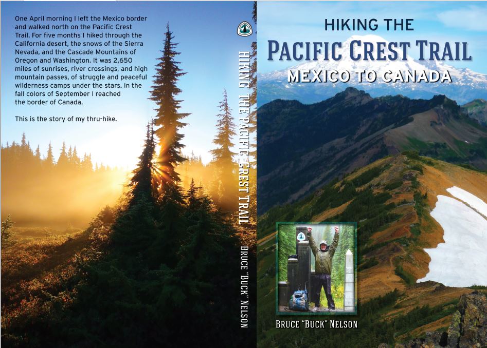
My new book is here. Order today!
My journal of my PCT hike can be found here.
My name is Bruce Nelson, aka Buck. On the long trails I follow the tradition of using my “trail name,” Colter. In 2010 I’m going to attempt a 2,650-mile hike of the Pacific Crest Trail (PCT.) This trail roughly follows the Sierra Nevada mountains of California, and then the Cascade Mountains of Northern California, Oregon and Washington. It starts at the border of Mexico and California and finishes on the Washington/Canada border. About 300 people a year attempt to “thru-hike” [as of 2021 its over 4,000!] the whole trail, and according to the Pacific Crest Trail Association, about 60% finish.
I like to pack light, and will be doing so again on this hike. I’ve posted my gear list here.
There is more information about the Pacific Crest Trail to be found at the links to the right and in the top menu: Thru-Hikes > Pacific Crest Trail
Please scroll down to see a list of “trail towns” and for a map of the trail’s route. And if you like maps, make sure you check out the link for the Postholer maps of the PCT. Really interesting!
Using Craig’s PCT Planner I generated a general hike plan. I am a firm believer in modifying a hike plan as necessary. Weather, fitness, snow levels, the fun factor, etc. will all play a role in changes made along the way, but this plan will still likely be in the ballpark and give a good idea of days between resupply points, etc. I’ll be starting out fairly slow, as I’m starting reasonably early in the season. This will give me plenty of time to get in good shape and give the snow in the high Sierras more time to melt. Sounds like that might be an especially good idea this year!
| Section | mi/day | ft/day | Distance (mi) | Elev. Gain (ft) | Days | Arrival |
| Campo (start) | 4-21-10 | |||||
| Campo to Warner Springs | 12.9 | 1052 | 110.6 | 8985 | 8.5 | 5-01-10 |
| Warner Springs to Idylwild | 12.2 | 1791 | 69.6 | 10211 | 5.7 | 5-07-10 |
| Idylwild to Big Bear City | 13.3 | 1703 | 96.1 | 12307 | 7.2 | 5-14-10 |
| Big Bear City to Wrightwood | 13.8 | 1242 | 89.6 | 8090 | 6.5 | 5-21-10 |
| Wrightwood to Agua Dulce | 13.4 | 1573 | 89.0 | 10428 | 6.6 | 5-29-10 |
| Agua Dulce to Tehachapi | 16.4 | 1871 | 100.2 | 11427 | 6.1 | 6-04-10 |
| Tehachapi to Kennedy Meadows | 14.4 | 1625 | 141.9 | 16045 | 9.9 | 6-15-10 |
| Kennedy Meadows to Vermillion Valley Resort | 18.6 | 3110 | 174.3 | 29128 | 9.4 | 6-24-10 |
| Vermillion Valley Resort to Red’s Meadow | 18.9 | 2882 | 29.4 | 4484 | 1.6 | 6-26-10 |
| Red’s Meadow to Tuolumne Meadows | 19.4 | 2485 | 36.1 | 4626 | 1.9 | 6-29-10 |
| Tuolumne Meadows to Sonora Pass | 18.7 | 3005 | 76.4 | 12250 | 4.1 | 7-04-10 |
| Sonora Pass to Echo Lake Resort | 20.0 | 2003 | 76.2 | 7635 | 3.8 | 7-09-10 |
| Echo Lake Resort to Sierra City | 19.9 | 2069 | 102.1 | 10606 | 5.1 | 7-14-10 |
| Sierra City to Belden | 19.6 | 2357 | 91.7 | 11056 | 4.7 | 7-19-10 |
| Belden to Chester | 19.0 | 2808 | 46.5 | 6875 | 2.4 | 7-21-10 |
| Chester to Old Station | 20.4 | 1658 | 41.9 | 3400 | 2.1 | 7-23-10 |
| Old Station to Burney Falls State Park | 21.6 | 687 | 45.9 | 1457 | 2.1 | 7-25-10 |
| Burney Falls State Park to Castella | 20.1 | 1938 | 82.9 | 8000 | 4.1 | 7-30-10 |
| Castella to Etna | 19.7 | 2205 | 99.8 | 11144 | 5.1 | 8-04-10 |
| Etna to Seiad Valley | 20.6 | 1518 | 56.8 | 4185 | 2.8 | 8-07-10 |
| Seiad Valley to Ashland | 18.8 | 2923 | 64.5 | 10002 | 3.4 | 8-12-10 |
| Ashland to Crater Lake Post Office | 20.1 | 1888 | 105.4 | 9883 | 5.2 | 8-17-10 |
| Crater Lake Post Office to Cascade Summit | 20.5 | 1638 | 79.6 | 6376 | 3.9 | 8-21-10 |
| Cascade Summit to Elk Lake Resort | 20.5 | 1577 | 46.1 | 3541 | 2.2 | 8-23-10 |
| Elk Lake Resort to Sisters | 19.8 | 2142 | 31.0 | 3350 | 1.6 | 8-24-10 |
| Sisters to Big Lake Youth Camp | 19.7 | 2246 | 11.4 | 1300 | 0.6 | 8-25-10 |
| Big Lake Youth Camp to Timberline Lodge | 19.9 | 2069 | 106.4 | 11055 | 5.3 | 8-30-10 |
| Timberline Lodge to Cascade Locks | 20.4 | 1710 | 49.3 | 4140 | 2.4 | 9-03-10 |
| Cascade Locks to White Pass | 19.1 | 2692 | 148.1 | 20837 | 7.7 | 9-11-10 |
| White Pass to Snoqualime Pass | 20.2 | 1848 | 98.6 | 9025 | 4.9 | 9-15-10 |
| Snoqualime Pass to Skykomish | 18.4 | 3308 | 74.5 | 13420 | 4.1 | 9-20-10 |
| Skykomish to Stehekin | 18.5 | 3169 | 97.8 | 16720 | 5.3 | 9-26-10 |
| Stehekin to Manning Park | 19.1 | 2734 | 88.8 | 12723 | 4.7 | 9-30-10 |
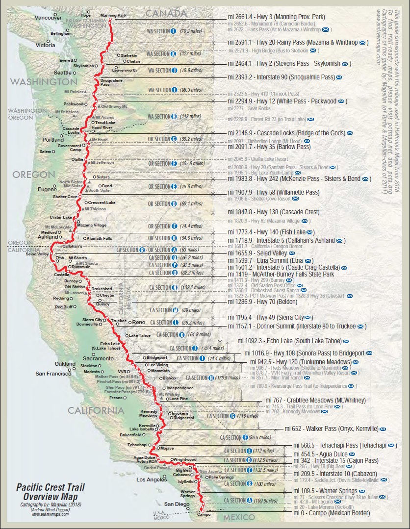
The above map from Halfmile’s PCT Maps
Postholer also has awesome maps.
Check them out. The PCT is displayed on your choice of satellite maps, terrain maps, road maps etc. It will plot where the towns are, the standard mail drop points, even allows you to choose photos of strategic spots. Very cool!
Hello Buck, I’ve been trying to plan a backpacking trip and I live very close to the PCT where it goes through White Water. So, I think I may try that for my first time. I just have a few questions. What time of year would be best to start? My brother tells me I’m crazy for going alone, would it really be that dangerous for a young woman to do this by herself? I’m also concerned about how much it would cost, roughly how much did you spend on supplies before you left and while you were on the trail? I’ve found your website very useful in helping me decide to do this, thank you.
Hi Phelycia,
So I take it you are thinking about thru-hiking? Many young women set out to hike the PCT on their own, overwhelmingly they do so safely. If my niece wanted to do a thru-hike on her own I wouldn’t worry. Most people soon make trail friends. You will want to use good judgment like normal life. Hitching to town for resupplies is common, I think it’s smart for women to hitch into town with a friend.
Most people set off on a PCT thru-hike about the third week of April. Costs vary wildly depending on how fancy your gear purchases are, how many nights you stay in town, etc. This is an article on costs. The PCTA says $4,000 to $8,000.
Good luck on your planning! I recommend buying Yogi’s PCT Handbook once you decide to go. It’s loaded with good info.
Buck