Thru-hiking, paddling, climbing, hunting, fishing, gear lists, tips, and more.

Month: June 2016 (Page 5 of 8)

Beyond the Yellowstone

June 14

This was a big, big day for me. It started out, however, as the buggiest morning of the whole trip. Mosquitoes were wrestling each other to get in the tent.  Caterpillars were plentiful. I believe there were 200 small snails on my tent and screen!

Fort Union


My goal for the day was the confluence of the Yellowstone River.  Four years ago I paddled down the Yellowstone and when I got to the Missouri River I tried paddling  up a little way. I had considered paddling up the Missouri River someday, but that day I decided that I would never try to paddle up the Missouri, it would be far too difficult.

It was a mostly sunny day. I had my solar charger out but my external battery was not taking a charge. My phone was taking a charge extremely slowly. I rely on those charges to make these posts. 

I made steady progress up the river switching sides as necessary. The wind was a mixed bag but there were times when it actually was helpful. 

I had been told about the river angels the Anderson’s below the confluence of the Yellowstone. Although I got off the river at the right spot I couldn’t find their house which I expected to be near the river or within sight. There was a four-wheel-drive road which I followed around and up to the top of the hill. There I got a completely different view of the world I have been seeing from the river, a world that now included farms and wheatfields. 

If I took a break off the river and went into the shade mosquitoes would descend upon me. It’s interesting that where Clark had so much trouble with mosquitoes on the return trip that I have gotten into the worst mosquitoes of the trip. 

I spotted a whitetail buck along the edge of the trees, he was frozen watching me, with two developing antlers already several inches tall, with a bird standing on his head perfectly framed between them!

It was another big day for pelicans They like to fly right over the water barely skimming above  it. 

I rounded a corner and recognized a spot that’s just below the confluence of the Yellowstone. It was exciting to soon see the Yellowstone flowing into the mighty Missouri. A large cottonwood log was just flloating out of the mouth of the Yellowstone. The rivers are higher than the last time I was here, there was no big sandbar between them now and so no good place to stop for an historical photo. It was a thrill to have paddled all the way here regardless. 

I was curious, of course, as to how the paddling would be compared to the last time where it had so discouraged me. For whatever reason it didn’t discourage me at all, perhaps because I was on the other side of the river. I moved steadily upstream. 

I was taking a break when I realized I wasn’t far from Fort Union. Too bad it was going to be closed already. Or was it?When I looked at my phone it said I was now in mountain time. I tried to call but there was no coverage. I paddled hard, trying to make it in time. I could use some water and I could charge my phone. 

I could see Fort Union across the river and found the side channel that Jeff Brown had described. I paddled up the channel and quickly gathered up water bottles in my charging stuff and hustled through the willows and up the hill. 

There were people! Clean people! The gate was open and I headed in to find out it would be open another hour. Yes! 

It is a nice reconstruction and it had  knowledgeable rangers. I checked out the fort and the displays thoroughly. This was the most important trading fort on the upper Missouri, run by the American Fur Company. I believe it started in 1828. 

Right now it’s closed and I’m sitting just outside up on the hill in the sun. I see I have a little bit of coverage so I’m going to try to send this out tonight. It is really exciting to be beyond the Yellowstone River! Colter

Clark: 26th of April Friday… I Sent a canoe up to Capt Lewis and proceeded measure the width of the rivers, and find the debth. The Missouri is 520 yards wide above the point of yellow Stone and the water covers 330 yards; the YellowStone River is 858 yards wide includeing its Sand bar, the water covers 297 yards and the deepest part is 12 feet water, it is at this time falling, the Missouri rising The Indians inform that the yellow Stone River is navagable for Perogues to near its Source in the Rocky Mountains…

Trip overview and route map with position updates: 

https://bucktrack.com/Lewis_and_Clark_Trail.htm

Westbound

June13, Day 82

My tent was soaked with condensation this morning. It’s interesting that one morning my tent will be completely dry and the next it will be soaked, just based on condensation conditions. 

The river water was at almost exactly the same level as it was last night. Maybe it didn’t rain that much upstream after all.

The best time to be on the river is early in the morning and to lesser extent late in the evening. The morning light is beautiful, saturating the natural colors. 

Morning on the Missouri


The river had a strong current most of the day, requiring a great deal of hard paddling. You can’t just dip your paddle in the water and hope you go zipping up the river, you gotta paddle like you mean it. A huge help, of course,is picking the slowest current, I crossed the river many times to look for slower current on inside bends, but sometimes I found the slowest current in the middle of the river. 

So far on this trip I’ve been following the Missouri River primarily westbound and northbound.  But now I’ve reached and passed the northernmost point on the Missouri. For the next few hundred miles I’ll be going mostly west towards the Pacific. 

I paddled past Williston and when I reached the bridge a mystery was solved.   A crew was using a crane to free debris from the bridge, debris like logs and sticks and bark. That explains why all that debris I’d seen floating didn’t indicate flooding up river. 

About the time I passed under the bridge I started having to fight a strong headwind as well. I’ll bet the people that watched me paddle by weren’t  very envious.  

It was difficult to find a good place to land for breaks today, much of the river was lined by steep banks or thick willows. At one spot I managed to climb the bank and tie off the boat and sit down in the shade. The bad news is the mosquitoes were thick. I am very tolerant of mosquitoes but I learned that this shirt is not mosquito proof like my other hiking shirts. I sprayed it with some DEET. 

I’ve gotten some good advice from various people about resupply ahead. I decided I would resupply at Culbertson and send some food to Fort Peck Marina, hoping that will last me all the way to Fort Benton. That stretch is a tougher resupply, heading upstream, fighting the current. After putting together a shopping list I gave my mom a call then emailed her the list. She, of course, quickly and efficiently did the shopping and the boxes are in the mail. 

Toward the end of the day the wind got strong enough so I was getting significant waves. I checked out one camp spot but it was invaded by some kind of tree caterpillars, which explained the denuded trees I’ve been seeing. I paddled another quarter-mile and found a nice camp spot in the cottonwoods. 

It’s raining just a bit and thundering some as well but I’m all set up and secure.  I figured I paddled about 23 miles upstream today. Not too shabby in my estimation. Colter

Lewis…April 21st 1805… We saw immence herds of buffaloe Elk deer & Antelopes. Capt Clark killed a buffaloe and 4 deer in the course of his walk today; and the party with me killed 3 deer, 2 beaver, and 4 buffaloe calves. the latter we found very delicious. I think it equal to any veal I ever tasted. the Elk now begin to shed their horns.

Lewis: April 22cd 1805… the wind became so hard a head that we proceeded with difficulty even with the assistance of our toe lines… the broken hills of the Missouri about this place exhibit large irregular and broken masses of rocks and stones; some of which tho 200 feet above the level of the water… I asscended to the top of the cutt bluff this morning, from whence I had a most delightfull view of the country, the whole of which except the vally formed by the Missouri is void of timber or underbrush, exposing to the first glance of the spectator immence herds of Buffaloe, Elk, deer, & Antelopes feeding in one common and boundless pasture… I met with a buffaloe calf which attatched itself to me and continued to follow close at my heels untill I embarked and left it. it appeared allarmed at my dog which was probably the cause of it’s so readily attatching itself to me. Capt Clark informed me that he saw a large drove of buffaloe pursued by wolves today, that they at length caught a calf which was unable to keep up with the herd.

Trip overview and route map with position updates: 

https://bucktrack.com/Lewis_and_Clark_Trail.html

Goodbye, Sakakawea

June 12, Day 81, Mile 1536

It was nice packing up by electric light with no dew or wind or sand to deal with. I was paddling just after 5 AM. With luck I could get in a few miles before the wind shut me down. With even better luck I could get across the lake and use the other shore as a partial wind buffer to put in more miles.

It was calm when I launched so I was surprised when I got beyond the protected water to find big waves. There was a good storm last night and it takes a long time for the waves to dissipate. While it was still nearly dark, I could see natural gas being burned off numerous oil wells in the distance, some with flames many feet tall. It seems like an enormous waste of energy.

I stayed on the south side of the lake until I rounded the corner. The waves were starting to dissipate and I was also getting some protection from the shore now. It proved to be an easy crossing of the lake.

It was about 7:30 when I took my first break. I’d gotten spoiled at other places on this lake, there were no wonderful discoveries to be made, it was a simple gravelly beach.

Nearing the end of the lake now, both sides were still largely looking like badlands. But unlike badlands I think of, parched and seemingly lifeless, these badlands were mostly green and lush, covered with grass, or trees in the draws.

Subsequent break spots were much more interesting. I found a bison vertebrae, a hump bone with a long “fin” on top. Of course, also petrified logs and stumps, and miscellaneous other buffalo bones. I even found an old wheel with a wooden hub.

Flooded willows began to encroach on the lake, it looked as if they extended a mile out. The lake levels must have been down for several years in a row recently allowing the willows to grow. Now with the levels back up they’ve been drowned out. There was a considerable headwind but I’d been reasonably successful sticking close to the bluffs with some wind protection from them. I wasn’t enthusiastic about paddling far out into the lake to get around the willows and then working my way back.

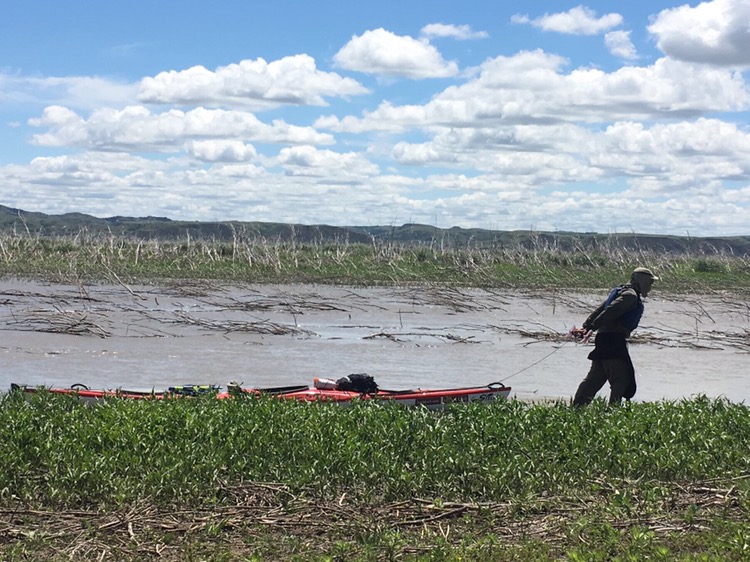
I tried a shortcut knowing that there was a good chance I would run out of water. In fact the water did get increasingly shallow. What gave me hope is what looked like an old open channel ahead of me. Eventually there wasn’t enough water to paddle and I got out to pull the boat. That was nearly as difficult, with soft, sticky mud trying to suck my shoes off my feet.

Dragging Upstream (yes, I am in the water.)


It was both encouraging and discouraging when I saw current marks swirling around the dead willows. I would probably reach deeper water, but now I would be fighting current as well. After another half hour the water began to get deeper and I was home free. 

Lake Sakakawea  was behind me, the last of the huge Dakota reservoirs. It was a significant victory. 

Now however I was back into some genuine current, making me choose my route carefully in order to make any progress. When I would take a break and look at the current it was hard to believe I was making progress at all, yet I was, sometimes 2 miles an hour or more. 

Around 6:30 PM I decided to call it a day. Tomorrow the winds should be more favorable. I was in a no-mans-land for camping though, away from the bluffs and trees and out in a meandering delta area. I picked one of the higher spots with several living willows in the area and checked it out. There was a tent spot about 4 feet above the water that would work fine. I pulled the boat well out of the water, tied it off and began carrying year over to my tent site. 

When I got back to the kayak I noticed many sticks and debris floating down the river. I learned on the Mississippi that that that was a sign of higher water upstream. I stuck a stick at the edge of the water and I’ve watched it since then and it’s only came up a bit. I’m confident I’ll be fine. It’s sunny and warm this evening with a pleasant breeze. I am pleased with today’s progress of about 25 miles or more.  Colter

Clark: 17th of April Wednesday 1805…some Pumice Stone floating in the river, I walked on the S. S. Saw great numbs. of Buffalow feeding in the Plains at a distance Capt. Lewis killed 2 Buffalow buls which was near the water at the time of dineing, they were So pore as to be unfit for use. …about Sunset Saw Some fresh Indians track and four rafts on the shore S. S. Those I prosume were Ossinniboins who had been on a war party against the Rockey Mountain Indians… Some verry large beaver taken this morning. those animals are made use of as food and preferred by the party to any other at this Season

Lewis: Thursday April 18th 1805. A fine morning, set out at an early hour. one Beaver caught this morning by two traps, having a foot in each; the traps belonged to different individuals, between whom, a contest ensued, which would have terminated, most probably, in a serious rencounter had not our timely arrival at the place prevented it… we were detained today from one to five P.M. in consequence of the wind which blew so violently from N. that it was with difficulty we could keep the canoes from filling with water altho they were along shore…

Lewis: Friday April 19th 1805. The wind blew So hard this morning from N. W. that we dared not to venture our canoes on the river… the wind detained us through the couse of this day, tho we were fortunate in having placed ourselves in a safe harbour.

Lewis: Saturday April 20th 1805. …soon after seting out, a part of the bank of the river fell in near one of the canoes and had very nearly filled her with water… the wind became so hard and the waves so high that it was with infinite risk [Clark] had been able to get as far as his present station… saw the remains of some Indian hunting camps, near which stood a small scaffold of about 7 feet high on which were deposited two doog slays with their harnis. underneath this scaffold a human body was lying, well rolled in several dressed buffaloe skins and near it a bag of the same materials containg sundry articles belonging to the disceased; consisting of a pare of mockersons, some red and blue earth, beaver’s nails, instruments for dressing the Buffalo skin, some dryed roots, several platts of the sweet grass, and a small quantity of Mandan tobacco… near the scaffold I saw the carcase of a large dog not yet decayed, which I supposed had been killed at the time the human body was left on the scaffold; this was no doubt the reward, which the poor doog had met with for… transporting her corps to the place of deposit.

Trip overview and route map with position updates: 

https://bucktrack.com/Lewis_and_Clark_Trail.html

« Older posts Newer posts »


Alone in the Fortress of the Bears cover

Order my books and DVDs!


web stats


June 2016
S M T W T F S
 1234
567891011
12131415161718
19202122232425
2627282930  

© 2025 Outdoor Adventures

Theme by Anders NorenUp ↑

Verified by ExactMetrics