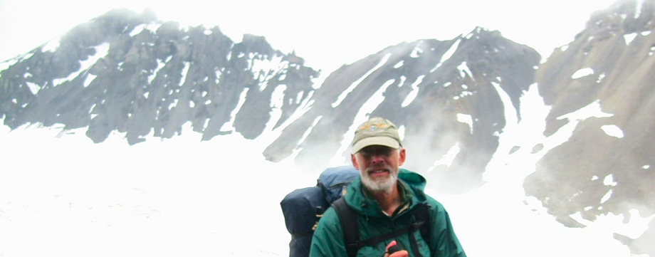

My Original Trip Plans
- My trip will start around June 17. My smokejumper buddy Marty Meierotto will fly me out if he isn’t fighting fire. If he’s busy, I’ll be flying with Coyote Air. On the flight in, I will drop three food caches along my route. Each cache will be a small steel box containing about a week’s worth of food.
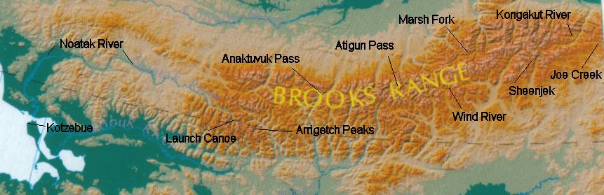
- My hike will follow headwater drainages paralleling the continental divide of the Brooks Range as much as possible. The end of my trip will be down the Noatak River.
- The first part of my hike will be in ANWR, the Arctic National Wildlife Refuge. I’m glad there are no oil wells there now, and I hope there never are. I’ll start along Joe Creek near the Canadian border, (east of the headwaters of the Kongakut and near the divide.) see below map
- From there I’ll hike west to the Kongakut River.
- My first food cache will be at the headwaters of the Sheenjek River, in the area I visited on my trip in 2000.
- The next part of my route will depend on how high the Sheenjek River is and how deep the snow in the passes is, but I’ll end up in the headwaters of the East Fork of the Chandalar River.
- I’ll cross Guilbeau Pass into the Hula Hula River headwaters, and from there to the Canning River.
- My next food cache will be in the headwaters of the Marsh Fork of the Canning River.
- After walking up the Ivishak, I’ll cross over to the Wind River and my next food cache.
- From there it will be the Middle Fork of the Chandalar, Your Creek and the North Fork of the Chandalar.
- I’ll cross the only road of the trip when I hit the Haul Road near Atigun Pass. I’ll have a cache along the road.
Some more landmarks I expect to see, in order: - Oolah Pass
- Itkillik River
- Cocked Hat Mountain
- Anaktuvuk River
- My next food cache will be mailed to and picked up in the village of Anaktuvuk.
- I’m going to be very flexible on the next part of my route, but will hike to the Arrigetch Peaks, where I’ll have my next food cache there to meet me. All caches are in bear-proof containers.
- After exploring the area, I’ll work my way to the headwaters of the Noatak, where I’ll have a cache, including a Soar Pro Pioneer inflatable canoe and a rifle.
- I plan to take bout 3-4 weeks traveling down the Noatak and exploring the area.
- I will no doubt visit Noatak Village along the way.
- After verifying the weather is favorable and the sound is calm, I’ll make the short dash across Kotzebue Sound to the village of Kotzebue.
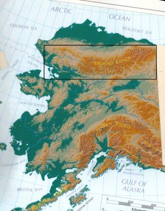
The below map shows the approximate location of some key points along my planned route.
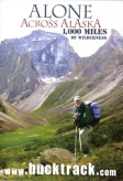
Order my DVD here!


Hello
How do you mail your food cache to the village of Anaktuvuk? I’m planning to hike through the little village and it would be great if I could pick up some food I have send by myself, because I’m not sure that I can buy the necessary food in the village.
Hi Michae,
I sent it to the Post Office, addressed like this:
Bruce L. Nelson
(Please hold for long distance hiker)
GENERAL DELIVERY
ANAKTUVUK PASS AK 99721-9999
To the side, I had written, in bold, something like “estimated arrival July 25.”
For small post offices that are not accustomed to handling General Delivery for strangers, I highly recommend calling them up ahead of time to let them know your plans.
There was a store in Anaktuvuk Pass but it was expensive and the choices were limited.
Have a great hike!
Buck
Buck, I’m 72 in very good shape, worked for Red Adney when I was a kid. I’d love to try your first part of the trip to the haul rd from where you started would you mind sharing your route? I hope this request/question is not offensive. If so my apology.
Hi Mike,
I’ve seen you on the Alaska Outdoors forum! You can see the general layout of my route on the map on this page as well as my route description. I don’t have a GPS track or even an accurate line drawn on a map. Nowadays, with Google Earth, you could probably plan a route as good or better using my general route as a starting point. The most marginal part of my route was, as I recall, a pass crossing from the Hula Hula over into the Canning River. I ended up walking up a canyon following a creek with steep sides, sometimes in the creek, sometimes scrambling up very steep and potentially dangerous slopes. I read an account of another fellow roughly following my route and I think he had an even more marginal experience. I was just looking at Google Earth now, and I’m not certain I could pick out my exact route at that point but it seemed like the natural path to take to cross over between drainages.
Sorry I don’t have a more precise route description but in a very real sense I like not having an established, GPSed route for people to follow. There’s magic in people exploring and discovering their own way.
I hope you have a great adventure!
Buck