

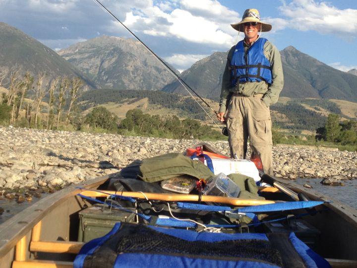
I had wanted to canoe the Yellowstone River for years and in July and August of 2012 I finally got my opportunity. Its about 557 miles from Gardiner, Montana to the Missouri River in North Dakota. Jim Griffin and I launched at McConnell Landing just below Gardiner, and used a raft to run Yankee Jim Canyon. At the fairly low water levels at the time we found it to be fairly easy with a raft. It can be very dangerous at higher water levels, or in a canoe, or for inexperienced rafters.
I had read the Yellowstone River is safe below Yankee Jim Canyon for competent beginner canoers. Untrue. Beginners would eventually end up in the water if going long distances because there are many rapids here and there, some with tight corners and standing waves plenty high to swamp a canoe. I am not a whitewater canoeing expert but have lots of canoeing experience. I nearly swamped the canoe once. Other places were exciting but I made it fine. Most of the river was a piece of cake with relatively warm water this late in the year and moderate water levels. If you carefully watch ahead, you should be able to line your canoe around most if not all marginal rapids.
There are also several diversion dams. I only had to portage one. The others I lined or took side channels around. It’s important to stay alert for these dams! Do not paddle over a diversion dam. They might look tame, but currents can easily trap and kill you.
On Facebook, Gregan Wortmann has said: Hazards include logjams, tricky currents and diversion dams. The 5 most dangerous diversion dams are at Huntley, Waco, Rancher Ditch, Forsyth and Intake with portages at Forsyth and Intake (both are portage river right — on the south bank). Extreme caution should be used in Yankee Jim Canyon where flows can reach over 15,000 cfs. Yankee Jim Canyon starts 13 miles below Gardiner and is 4 miles of some of the best white water in Montana — Class 2 and easy Class 3 but at peak flow (over 15,000 cfs) can be a dangerous Class 4.
Conditions change, so stay alert and scout every diversion dam before enacting a plan.

I did lots of fishing. There were rainbows and brown trout up high, down to Laurel or so. I caught smallmouth bass in mid-river, and catfish, goldeye, drum, sauger and carp from mid-river to the confluence. Sight-fishing for carp with flyfishing gear was really fun. They are smart and strong! Don’t forget to pinch the hook barbs for all fishing: http://www.catchphotorelease.com/cpr.htm
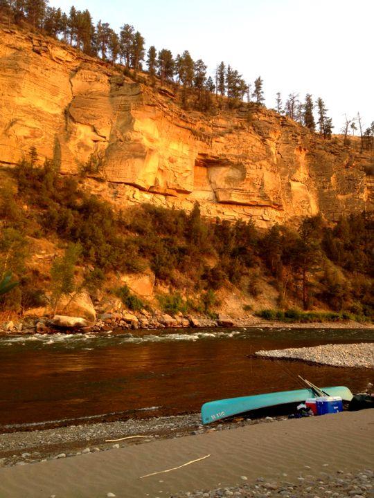
It was easy to find places to camp. In Montana you can legally camp below high water mark. There was also public land in places including BLM land, and fishing access sites which sometimes allow camping. I resupplied in places like Columbus, Forsyth, Miles City, and Glendive.
Wildlife was plentiful: mule deer and whitetail, elk, beaver and mink, eagles, ospreys, pelicans and geese. The scenery was awesome, big mountains up high, with bluffs further down.
Most of the river has a good current. It took me 23 days including lots of fishing. There was considerable wind at times, as often as not a tailwind. When the winds were especially bad I’d stop and make camp early. Nice!
The Yellowstone is a very historical river too. It was interesting to see Captain Clark’s signature at Pompey’s Pillar where there is also a nice visitor’s center. There is also a great museum at the confluence, Fort Union. This was one of my favorite paddles.
If you start at Livingston MT is it fairly flat water until the Missouri?
There are a few tight bends, including one in Livingston. Be prepared to check out tough spots and walk your boat around inside bends if necessary.
The diversion dams are potentially dangerous and easily avoided if you stay alert.
Wear your life jacket and stow your gear for a possible flip. Most of the river below Livingston is an enjoyable piece of cake. Have fun!
Buck
Buck, from Yankee Jim Canyon to the confluence are there many bear issues if any?
Hi CBT,
You rapidly get out of good bear habitat heading downstream. I didn’t see a bear or a bear track the whole way.
Have fun!
Buck
Sounds like a great trip. What did you do for drinking water?
On this Yellowstone trip I treated river water with Aquamira drops . I also had maybe two gallons to start with and occasionally filled up my containers with water in towns.