

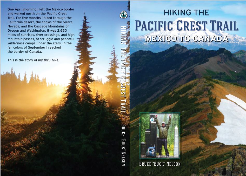
My new book is here. Order today!
My journal of my PCT hike can be found here.
My name is Bruce Nelson, aka Buck. On the long trails I follow the tradition of using my “trail name,” Colter. In 2010 I’m going to attempt a 2,650-mile hike of the Pacific Crest Trail (PCT.) This trail roughly follows the Sierra Nevada mountains of California, and then the Cascade Mountains of Northern California, Oregon and Washington. It starts at the border of Mexico and California and finishes on the Washington/Canada border. About 300 people a year attempt to “thru-hike” [as of 2021 its over 4,000!] the whole trail, and according to the Pacific Crest Trail Association, about 60% finish.
I like to pack light, and will be doing so again on this hike. I’ve posted my gear list here.
There is more information about the Pacific Crest Trail to be found at the links to the right and in the top menu: Thru-Hikes > Pacific Crest Trail
Please scroll down to see a list of “trail towns” and for a map of the trail’s route. And if you like maps, make sure you check out the link for the Postholer maps of the PCT. Really interesting!
Using Craig’s PCT Planner I generated a general hike plan. I am a firm believer in modifying a hike plan as necessary. Weather, fitness, snow levels, the fun factor, etc. will all play a role in changes made along the way, but this plan will still likely be in the ballpark and give a good idea of days between resupply points, etc. I’ll be starting out fairly slow, as I’m starting reasonably early in the season. This will give me plenty of time to get in good shape and give the snow in the high Sierras more time to melt. Sounds like that might be an especially good idea this year!
| Section | mi/day | ft/day | Distance (mi) | Elev. Gain (ft) | Days | Arrival |
| Campo (start) | 4-21-10 | |||||
| Campo to Warner Springs | 12.9 | 1052 | 110.6 | 8985 | 8.5 | 5-01-10 |
| Warner Springs to Idylwild | 12.2 | 1791 | 69.6 | 10211 | 5.7 | 5-07-10 |
| Idylwild to Big Bear City | 13.3 | 1703 | 96.1 | 12307 | 7.2 | 5-14-10 |
| Big Bear City to Wrightwood | 13.8 | 1242 | 89.6 | 8090 | 6.5 | 5-21-10 |
| Wrightwood to Agua Dulce | 13.4 | 1573 | 89.0 | 10428 | 6.6 | 5-29-10 |
| Agua Dulce to Tehachapi | 16.4 | 1871 | 100.2 | 11427 | 6.1 | 6-04-10 |
| Tehachapi to Kennedy Meadows | 14.4 | 1625 | 141.9 | 16045 | 9.9 | 6-15-10 |
| Kennedy Meadows to Vermillion Valley Resort | 18.6 | 3110 | 174.3 | 29128 | 9.4 | 6-24-10 |
| Vermillion Valley Resort to Red’s Meadow | 18.9 | 2882 | 29.4 | 4484 | 1.6 | 6-26-10 |
| Red’s Meadow to Tuolumne Meadows | 19.4 | 2485 | 36.1 | 4626 | 1.9 | 6-29-10 |
| Tuolumne Meadows to Sonora Pass | 18.7 | 3005 | 76.4 | 12250 | 4.1 | 7-04-10 |
| Sonora Pass to Echo Lake Resort | 20.0 | 2003 | 76.2 | 7635 | 3.8 | 7-09-10 |
| Echo Lake Resort to Sierra City | 19.9 | 2069 | 102.1 | 10606 | 5.1 | 7-14-10 |
| Sierra City to Belden | 19.6 | 2357 | 91.7 | 11056 | 4.7 | 7-19-10 |
| Belden to Chester | 19.0 | 2808 | 46.5 | 6875 | 2.4 | 7-21-10 |
| Chester to Old Station | 20.4 | 1658 | 41.9 | 3400 | 2.1 | 7-23-10 |
| Old Station to Burney Falls State Park | 21.6 | 687 | 45.9 | 1457 | 2.1 | 7-25-10 |
| Burney Falls State Park to Castella | 20.1 | 1938 | 82.9 | 8000 | 4.1 | 7-30-10 |
| Castella to Etna | 19.7 | 2205 | 99.8 | 11144 | 5.1 | 8-04-10 |
| Etna to Seiad Valley | 20.6 | 1518 | 56.8 | 4185 | 2.8 | 8-07-10 |
| Seiad Valley to Ashland | 18.8 | 2923 | 64.5 | 10002 | 3.4 | 8-12-10 |
| Ashland to Crater Lake Post Office | 20.1 | 1888 | 105.4 | 9883 | 5.2 | 8-17-10 |
| Crater Lake Post Office to Cascade Summit | 20.5 | 1638 | 79.6 | 6376 | 3.9 | 8-21-10 |
| Cascade Summit to Elk Lake Resort | 20.5 | 1577 | 46.1 | 3541 | 2.2 | 8-23-10 |
| Elk Lake Resort to Sisters | 19.8 | 2142 | 31.0 | 3350 | 1.6 | 8-24-10 |
| Sisters to Big Lake Youth Camp | 19.7 | 2246 | 11.4 | 1300 | 0.6 | 8-25-10 |
| Big Lake Youth Camp to Timberline Lodge | 19.9 | 2069 | 106.4 | 11055 | 5.3 | 8-30-10 |
| Timberline Lodge to Cascade Locks | 20.4 | 1710 | 49.3 | 4140 | 2.4 | 9-03-10 |
| Cascade Locks to White Pass | 19.1 | 2692 | 148.1 | 20837 | 7.7 | 9-11-10 |
| White Pass to Snoqualime Pass | 20.2 | 1848 | 98.6 | 9025 | 4.9 | 9-15-10 |
| Snoqualime Pass to Skykomish | 18.4 | 3308 | 74.5 | 13420 | 4.1 | 9-20-10 |
| Skykomish to Stehekin | 18.5 | 3169 | 97.8 | 16720 | 5.3 | 9-26-10 |
| Stehekin to Manning Park | 19.1 | 2734 | 88.8 | 12723 | 4.7 | 9-30-10 |
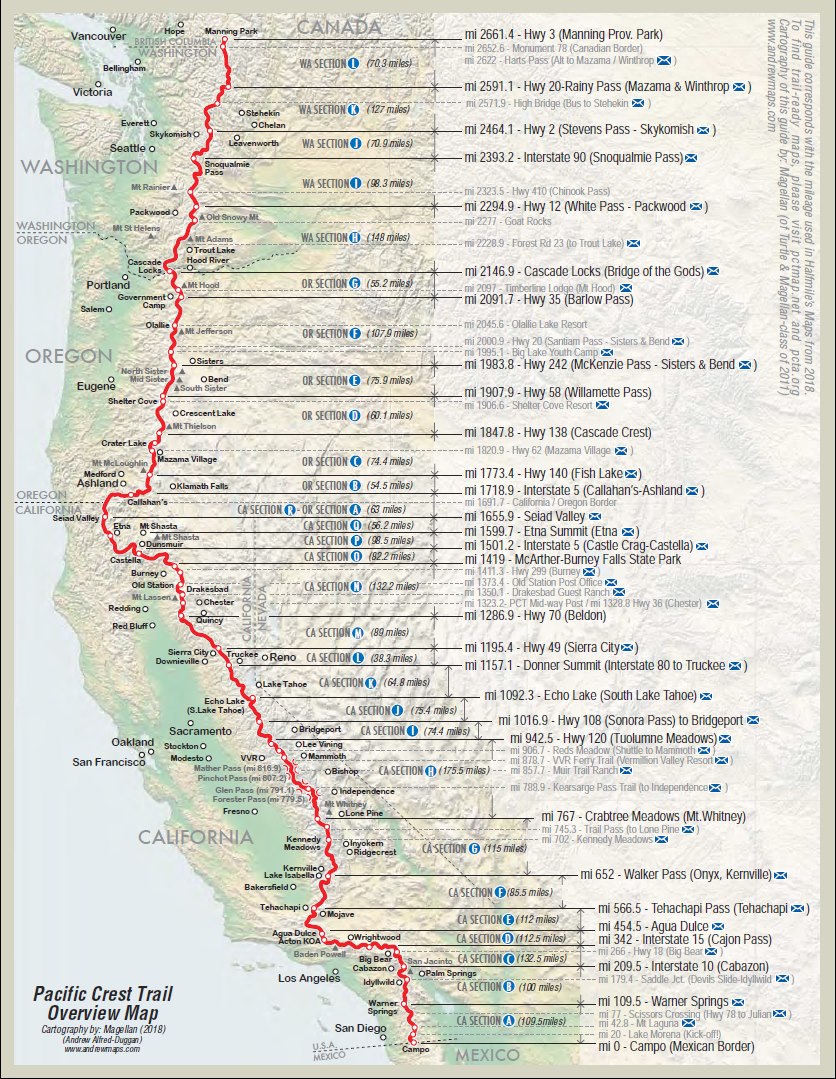
The above map from Halfmile’s PCT Maps
Postholer also has awesome maps.
Check them out. The PCT is displayed on your choice of satellite maps, terrain maps, road maps etc. It will plot where the towns are, the standard mail drop points, even allows you to choose photos of strategic spots. Very cool!
WOW are you a true inspiration.
can you please rate all these US hike-thrus in degrees of difficulty to you: weather (wx), physical challenge -terrain – supplies – (I know u take a lot of time out to pre-cache) etc.
Have you gone overseas ; or will you? (Gobi, Sahara, Bone Road, Empty… etc)?
thank you for taking this time and posting such valuable info for trekkers and ‘visiting fools’ of this planet like myself!!!
Blue skies, Fair Seas, Following Winds, and Safe Passages
!!!!!!!!!!!!!
Hi AK, The weather was probably the toughest on my Alaska Traverse. Some old Eskimos said it was the rainiest summer in memory. That was probably my toughest hike as far as terrain as well. The steepest per mile was probably the Appalachian Trail. The most complex for supplies might well have been my Desert Trail hike because I needed so many water caches. 2010 was a big snow year on the PCT and that was the most challenging aspect. The Continental Divide Trail was challenging for many reasons: navigation, length, remoteness and snow. All those hikes were great experiences… Read more »