Thru-hiking, paddling, climbing, hunting, fishing, gear lists, tips, and more.

Month: August 2016 (Page 2 of 7)

Down the Clearwater River

August 23-24

I had a good sleep, a long one too with the shortening days.

When I began walking down the road just before sunrise it seemed as if there were whitetail deer everywhere, left, right, feeding in fields and yards.

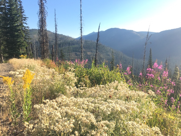
There were more and more wild apple trees growing along the road, branches sagging with fruit, plum trees and blackberries, rose hips and other wild berries of many kinds. I ate my fill of sweet plums and blackberries. What a treat!
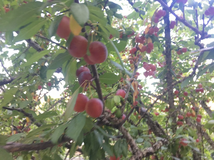
Plums!

This was definitely the most wild-food rich stretch of the trip so far, and the past and present homeland of the Nez Perce. They had rivers full of salmon and buffalo over the mountains via the Lolo Trail.

Jim Griffin would be meeting me in Orofino, but I had no coverage to update him on my arrival. I stopped at a restaurant for breakfast and used their WIFI to call Griff. He was on the way.

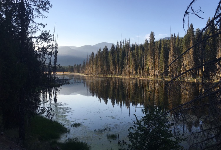
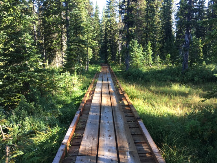
Down the road I checked out the site of Canoe Camp. Lewis and Clark must have been just as excited as me to start a downstream journey.

Griff and Lora, his wife, arrived just a few minutes after me. We had a good chat as I sorted through my kayaking gear they had brought, as well as my backpacking gear, deciding what to bring downriver and what Griff would store. Lora had some fresh baked goods to send with me. Great friends! Thanks for the help you two.

Launching on the Clearwater

After some photos and rudder-pedal adjustments I paddled downriver.

I’d heard varying reports for this stretch of the Clearwater, from serious rapids to a piece-of-cake. After the first stretch of rapids I definitely put on my spray skirt!  The river was fast, and some rapids dropped down steeply enough that it was hard to see what line to run until I was almost committed. There were considerable standing waves in places, and very fast, strong side currents at times. I definitely didn’t care to end up in that fast, cold water.

Overall though, most of the river was easy. I was making about 8 miles an hour with minimal paddling, and made it about 14 miles downriver in two hours or so, even with a couple gear tweak stops. I set up camp in a hidden spot, and picked fresh blackberries for supper.

August 24

I started my adventure five months ago today!

With my inflatable mattress I slept especially well, and packed up leisurely.

The clear, cold water carried me downstream at a thrilling pace. If the whole trip had been this fast I would have finished months ago.
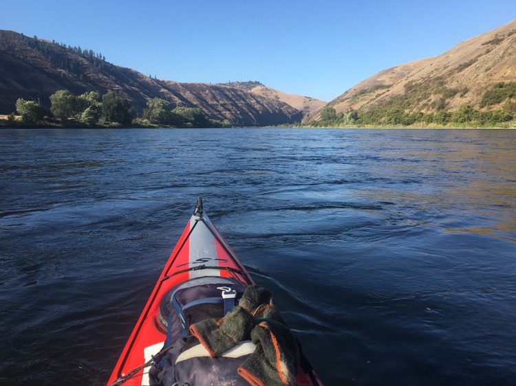
Clearwater River

I was more confident with the rapids today. I definitely stayed alert and steered clear of the worst spots where the current  must have been going 15 mph, a bad speed to hit a rock, especially if you’re drifting sideways.

At a good landing place opposite the highway were bushes hanging with blackberries. I stopped and picked handfuls of them. What I would have given to have had such plentiful, sweet berries on my “Fortess of the Bears” trip!
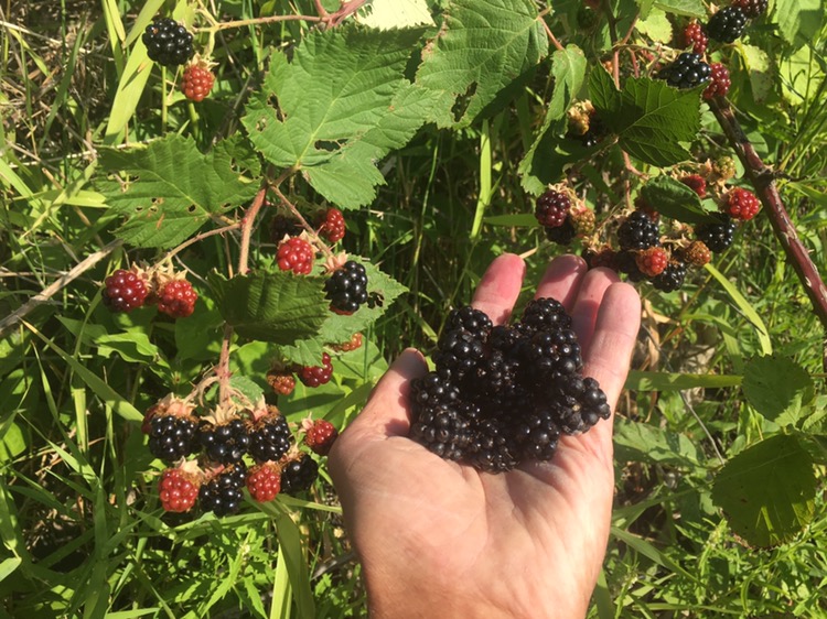
Blackberries!

The miles flew by. Nearing Lewiston I finally got cell coverage. I called my old smokejumper buddy Sunil Ramalingham to arrange a rendezvous in town.

Maps can be misleading at times. There was a bridge in town that wasn’t shown on my map at all.

This was now an inland port of the ocean. Two big barges were being loaded with grain, thousands and thousands of bushels pouring in in plumes of dust, one barge’s bow up high as the fully loaded stern rode low.

A reporter for the Lewiston Tribune who wanted an interview took photos as I paddled up to a landing on the Clarkston side. (Hey, I was in Washington!) Eric Barker was his name and we talked in the shade. As the Outdoors reporter he was very knowledgeable about the area.

Later I slipped the cart on my kayak and made the short tow up to my motel where I got a hot shower and threw my clothes in the washing machine.

Sunil arrived later, looking much as I last saw him 20 years ago. Could it really be twenty years?! It hardly seems possible. We had a good talk getting caught up and about the old days of smokejumping and old friends. There were many good laughs. Thanks for making the drive Sunil!

I haven’t had a full day off in nearly a month, so I’ll be taking a full day off tomorrow. This is a good place: near the river with stores and restaurants just a short distance away. Colter

[Note: my guess for arrival at the Pacific, assuming things go smoothly, is about September 15.]

Clark: Tuesday 26th Septr. 1805 Set out early and proceeded on down the river to a bottom opposit the forks of the river on the South Side… I had the axes distributed and handled and men apotned. ready to commence building canoes on tomorrow, our axes are Small & badly Calculated to build Canoes of the large Pine, Capt Lewis Still very unwell, Several men taken Sick on the way down…

Septr. 27th Thursday 1805 Set all the men able to work abt. building Canoes, Colter returned and found one horse & the Canister of Shot left in the mountains he also killed a Deer 1/ 2 of which he brought hot day—men Sick

October 6th Sunday 1805… had all our Saddles Collected a whole dug and in the night buried them, also a Canister of powder and a bag of Balls at the place the Canoe which Shields made was cut from the body of the tree—The Saddles were buried on the Side of a bend about 1/ 2 a mile below—all the Canoes finished this evening ready to be put into the water… 

October 8th Tuesday 1805… one canoe in which Serjt. Gass was Stearing and was nearle turning over, She Sprung a leak or Split open on one Side and Bottom filled with water & Sunk on the rapid, the men, Several of which Could not Swim hung on to the Canoe, I had one of the other Canoes unloaded & with the assistance of our Small Canoe and one Indian Canoe took out every thing & toed the empty Canoe on Shore, one man Tompson a little hurt, every thing wet perticularly the greater part of our Small Stock of merchindize, had every thing opened, and two Sentinals put over them to keep off the Indians, who are enclined to theave haveing Stole Several Small articles those people appeared disposed to give us every assistance in their power dureing our distress…

Trip overview and route map with position updates:

https://bucktrack.com/Lewis_and_Clark_Trail.html

West from Wieppe

August 22, Day 153, Mile 2,800

Big Creek Canyon

I tried to find an open cafe but failed. Instead, I made a pot of coffee and ate some tortillas with peanut butter, washed down with coffee/hot chocolate.

Although I’d kept notes during the last days and worked on my journal last night, it still took at least three more hours to catch up today. In the background I was half-watching Jeremiah Johnson. Journaling, which includes photo selection and captioning, writing up the day’s events, and selecting quotes from the Lewis and Clark journals is a considerable task.

It was about 10 when I headed to the gas station for ice cream. A friendly and enthusiastic lady who I’d met last night at the Mexican place told me again how thrilled she was with my journey, and introduced me to her mother who worked at the register. My adventure clearly did not capture the imagination of her mother, however.

I walked to the library to use the WIFI to post my journal. It took another hour to cut and past my text onto my site and fix most of the formatting issues. I successfully posted it before it could suddenly evaporate, which has happened before on this trip. The thought of losing all those hours of work was nearly too much to contemplate.

I checked out the excellent Lewis and Clark murals on the outside walls of the Library and then headed down the road. After a few miles I turned off on a gravel road that traversed grain fields, farms and ranches. The strong, dry scent of wheat being harvested drifted in the cool breeze. And it WAS pleasantly cool today, some of the most ideal temps of the trip.

I made another horse buddy by scratching behind her ears after she walked to the fence to meet me. She followed for more. I obliged. I saw several whitetail deer. It was good habitat with a mix of rolling crop lands and forest.

Service berries were plentiful, along with an occasional wild apple tree growing along the road. I ate as many apples as I liked.
In the afternoon the quiet road slowly contoured down the sides of a scenic canyon, with steep grassy openings in the timber. With no guard rails I shuddered to think what would happen if a car slid off the road. At one washout on the canyon side I saw where a tire had hung half over empty space; asking for trouble, for sure!

A pickup stopped to chat. Someone had told him about my trip.

At about 5 PM and after about 15 miles I looked for a place to camp. The first two places were too windy. The third, a mile later, was beneath a ponderosa and a fir tree, where my sleeping pad and bag became my home for the night. Colter

Clark: Sunday 24th Septr. 1805 a fine morning collected our horses despatched J. Colter back to hunt the horses lost in the mountains & bring up Some Shot left behind, and at 10 oClock we all Set out for the river and proceeded on by the Same rout I had previously traveled, and at Sunset We arrived at the Island on which I found the Twisted hare and formed a Camp on a large Island a littl below, Capt Lewis Scercely able to ride on a jentle horse which was furnishd by the Chief, Several men So unwell that they were Compelled to lie on the Side of the road for Some time others obliged to be put on horses. I gave rushes Pills to the Sick this evening. Several Indians follow us.

Lolo Trail

August 16-21 Day 146-151

August 16
Old smokejumper buddies Bruce Ford, Steve Baker and I drove down to Lolo Hot Springs for a good breakfast and coffee. Many laughs were enjoyed with the food.

We dropped off Steve’s motorcycle at Lolo Pass then Bruce brought us back to where I finished the day before. Steve and I said goodbye to Bruce and then walked up the road a way before turning off to pick up the trail. We had to do a bit of cross country hiking and climb over plenty of deadfall before seeing the welcome Lewis and Clark Trail emblem.

From there we walked on real hiking trail. It was a luxury hiking mostly in the shade of the big timber as well. We ate the first huckleberries of the trip and walked through Packer Meadows.

At Lolo Pass we got some info and Steve bought a map. We agreed to meet at 7 PM wherever I ended up along the road.
I made good time on the steady downhill. Like Lemhi Pass, the west side of the pass was much more lush.

I’d made about nine more miles when Steve motored up. He scouted ahead for a campsite. It was a fine spot in big cedars and near the Lochsa River. We had a fine time, and stayed up late telling stories.

Clark: September 13th Wednesday 1805… passed Several Springs… I tasted this water and found it hot & not bad tasted… I put my finger in the water, at first could not bare it… we proceeded over a mountain to the head of the Creek which we left to our left and at 6 miles from the place I nooned it, we fell on a Small Creek from the left which Passed through open glades Some of which 1/ 2 a mile wide, we proceeded down this Creek about 2 miles to where the mountains Closed on either Side crossing the Creek Several times & Encamped… Some mountains in view to the S E & S W. Covered with Snow.

Steve Baker

Cedar Camp

August 17
I got up early. Lochsa Lodge for breakfast was the goal. Steve showed up just as I was nearing the lodge.

It was a beautiful log building and breakfast was great. We firmed up the plan for the food cache and water caches that Steve would leave along the Lolo Trail and parted ways. It had been really fun hanging out with my old Bro.
I followed the L&C hiking trail along the river then turned to begin the long climb of Wendover Ridge where the Corps had left the Lochsa on the same climb. I was starting at about 3,200 feet and climbing to 6,600 feet.

The trail started among the cedars and stayed in the timber for a long time. There were at least a hundred trees down across the trail. The shade eased the heat of the steep climb. When the trail entered long openings from old forest fires a nice breeze helped considerably. The first fall colors were visible here and there.

There was more up and down than I’d expected, adding considerable climbing.

After several hours I made the ridge. It was extremely important that I find Steve’s food cache, it contained all my food for the next five days. Happily he’d put it in exactly the right spot, hung high in an expert bear proof fashion. At the base of the tree was five quarts of water. This cache had really lightened my pack. I had a good meal and drank all the cool water I wanted.

I walked a mile or so before setting up my tent at a flat spot along the ridge. It was nearly dark when I heard a deer walking towards me. I could barely see the huge ears of the doe against the sky as she walked closer and closer, so close I thought she might trip on my tent lines, sniffing loudly. It was fun to get so close to a large wild animal.

Clark: Wednesday Septr. 15th 1805… here the road leaves the river to the left and assends a mountain winding in every direction to get up the Steep assents & to pass the emence quantity of falling timber which had falling from dift. causes i e. fire & wind and has deprived the Greater part of the Southerley Sides of this mountain of its gren timber, 4 miles up the mountain I found a Spring and halted for the rear to come up and to let our horses rest & feed, about 2 hours the rear of the party came up much fatigued & horses more So, Several horses Sliped and roled down Steep hills which hurt them verry much…

Lochsa Pond

Huckleberries

August 18
It was a day of great, long mountain views as I followed the quiet road along the Lolo Trail. There was a little smoke haze from some distant fire. I knew I’d be doing lots of climbing when the road dropped well over a thousand feet then began the long climb to regain the altitude.

Huckleberries were plentiful and I’d stop to pick them at especially good spots. I saw an old “Indian Tree” bent long ago to mark the trail. I also found a silver dime from 1951.

I was resting at a water cache Steve had left when the first car drove up. It was a very friendly couple, curious about my trip.

An hour before dark two motorbikes drove up and asked if I was the guy who’d come from St. Louis. They gave me a cold beer and we talked about adventuring as dusk fell. Just before dark they headed east and I headed west.

I camped in the huckleberries beneath the stars. When the full moon rose I could see well enough to pick ripe berries from my sleeping bag.

wildflowers

“Indian Tree” marker tree

Along the Lolo Trail

August 19
A cold wind blew across the face of the moon and swayed the lodgepole pines above my sleeping bag.

I gathered fresh huckleberries for breakfast. My jacket felt great when I started hiking. Before noon though, the summer heat was back.

When I checked my position on my iPhone it was an hour earlier than I expected. When did I enter Pacific Time?

A grouse exploded from the huckleberries, making me jump, a blue grouse I think. I’d seen spruce grouse too.

Occasionally wooden signs marked landmarks along the way. Usually Bears had scratched the posts with their claws and as often as not had partially chewed up the signs. Despite all the berries there didn’t seem to be many bears around now.

I found a motorcycle license plate on the road. By going through my photos I saw that it was Steve’s. Small world! I picked it up to possibly mail to him.

Three rocks on the rugged road’s edge marked another hidden water cache Steve had left. Natural water had been hard to come by near Wendover Ridge, but here it just saved me the hassle of treating.

I slept in a mountain saddle under big timber.

Clark: Monday 18th Septr. 1805 a fair morning cold I proceded on in advance with Six hunters to try and find deer or Something to kill we passed over a countrey Similar to the one of yesterday more falling timber passed Several runs & Springs passing to the right from the top of a high part of the mountain at 20 miles I had a view of an emence Plain and leavel Countrey to the S W. & West at a great distance a high mountain in advance beyond the Plain, Saw but little Sign of deer and nothing else, much falling timber, made 32 miles and Encamped on a bold running Creek passing to the left which I call Hungery Creek as at that place we had nothing to eate. I halted only one hour to day to let our horses feed on Grass and rest


August 20

I picked up some good hiking trail this morning, trail marked with the Lewis and Clark or Nez Perce emblem.

It was warm in the sun but very cool in the shade. It was good to be hiking a long stretch of foot trail again.

The trail neared a low, wet meadow, crossed by a boardwalk. A boardwalk! A black animal came out of the shadows and loped towards me. A wolf! It froze, then whirled and ran back the way it came. Wow! It had been half grown. In the dust beyond the meadow were tracks of other members of the pack.

The route passed through old and recent burns and hot sun, and then through long shaded stands of dark timber, draped with sun-dappled green moss.

My route called for another long stretch of trail but I couldn’t find the trailhead. I tried heading cross country to intersect it but it was rough country for cross-country travel and there was no sign of trail.

I got back on the road. Just as I was about to give up on the trail I found the trailhead and the three rocks marking the last of Steve’s water caches, water I could use right now.

The trail was barely visible in places at first, but then most fallen timber had been cleared off the trail, making for a fairly easy walk through ferns and big timber: fir, ponderosa and cedar.

The trail came back to the road for a bit. Two ladies stopped and gave me some tangerines and cold water.

Signs marked a couple of Lewis and Clark camps. I followed another stretch of hiking trail back up into the evening shadows. There were no human tracks but deer and elk were making heavy use of the trail.

The days were getting shorter. Under the thick cedars, and now in Pacific Time, dark was coming early. I camped on a flat spot in the cedars, once again forgoing my tent.


The trail was barely visible in places at first, but then most fallen timber had been cleared off the trail, making for a fairly easy walk through ferns and big timber: fir, ponderosa and cedar.


The trail came back to the road for a bit. Two ladies stopped and gave me some tangerines and cold water.


Signs marked a couple of Lewis and Clark camps. I followed another stretch of hiking trail back up into the evening shadows. There were no human tracks but deer and elk were making heavy use of the trail.


The days were getting shorter. Under the thick cedars, and now in Pacific Time, dark was coming early. I camped on a flat spot in the cedars, once again forgoing my tent.

Where the wolf appeared

Water cache

Log chopped off trail

Rare footbridge

Big Cedars

August 21
I heard animals, elk I think, last night. I noticed a big whitetail antler near my sleeping bag when I got up.

This morning was the most beautiful stretch of trail on the whole trip, big timber, cool air and well-maintained trail.

All the logs cleared off the trail had been chopped off, a huge chore. Why the trail clearing crew hadn’t used a chainsaw, or at least a crosscut saw, was a mystery. Then I noticed sawdust at each log, and that each removed piece of log was missing. Apparently trail-clearing was being used as training for chopping and sawing for Boy Scouts and the Northwest Children’s Home as evidenced by two signs I saw.

It was fun to think that some of these ancient trees along the trail had witnessed the passing of Lewis and Clark and hundreds of years of Nez Perce hunters.

I waded Lolo Creek and followed the logging road on the other side. It was a long time before I saw the first pickup truck.

The landscape had a unique look, patches of open prairie in the timber. In late afternoon I walked into Wieppe. The fellow running the gas station/grocery store was super helpful. I bought some food and he called a local lady who set me up with a large private trailer for $50, $25 when she found out I was doing the Lewis and Clark Trail. Thanks! Running water, TV and a soft bed, quite a luxury. I ate a good meal of Mexican food at a roadside stand. A nice way to end a big day. Colter

Clark: Wednesday 20th September 1805… decended the mountain to a leavel pine Countrey proceeded on through a butifull Countrey for three miles to a Small Plain in which I found maney Indian lodges, at the distance of 1 mile from the lodges… a man Came out to meet me with; great Caution & Conducted us to a large Spacious Lodge which he told me (by Signs) was the Lodge of his great Chief who had Set out 3 days previous with all the Warriers of the nation to war on a South West derection… they gave us a Small piece of Buffalow meat, Some dried Salmon beries & roots in different States… I find myself verry unwell all the evening from eateing the fish & roots too freely…

« Older posts Newer posts »

© 2024 Outdoor Adventures

Theme by Anders NorenUp ↑