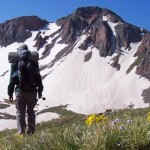
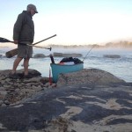
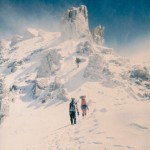
Welcome! This site is dedicated to outdoor adventuring. Click the menu links along the top, check out the adventures below, use the search box at the very bottom, or click on the site map to quickly locate the topic you are looking for. Comments are appreciated. Enjoy your day!
Buck, Looking through your website — an incredible portfolio. I am really impressed. And to think that I tried in my early days to live off the land by fishing in No Cal rivers. It didn’t work for long, so I took up backpacking ……. I’m retired now and have been looking at the Oregon hikes. I’m especially interested in the one you did from Highway 78 to Drinkwater, the last one that Ross Eginton wrote up for the DTA but never proofed. I downloaded your maps for that, but I am wondering if you have a line of GPS… Read more »
Thank you Steve! I think you should be able to download a track in kml format as referenced in the following paragraph. There are free online options to convert to gpx of necessary.
Good luck!
Buck
“View Desert Trail: Warm Springs Segment in a larger map where can download the .kml file if you want and convert it for use with most GPS units.”
https://maps.google.com/maps/ms?msa=0&msid=205719422215404012799.0004e2748137d1b1c31ea&hl=en&ie=UTF8&t=m&ll=43.443862,-118.17873&spn=0.678435,0.203034&source=embed
If that doesn’t work “buck-30” should have the whole route here: https://drive.google.com/drive/mobile/folders/1VEH7GE_RQl1o04_98i-VCk-KI9AYNKsw?usp=drive_open