
Like this page? Please click the “Like” button, above!
CLICK HERE for the stories and photos at my Desert Trail thru-hike journal.
Steve Tabor has written the following Desert Trail guidebooks which cover California (except Death Valley) and Nevada (except from High Rock Canyon north.)
If you are going to hike any part of the Desert Trail, you’ll definitely want to check out the info from Buck30’s 2019 thru-hike:
Buck30’s Desert Trail Summary and Planning
California Book I: Anza-Borrego Segment [Mexico to Mecca]
California Book II: Colorado Desert Segment [Mecca to Interstate 10]
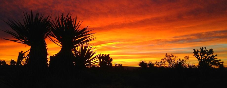
California Book III: Joshua Tree National Park Segment [Interstate 10 to State Highway 62]
California Book IV: South Mojave Segment [State Highway 62 to Interstate 40]
California Book V: Mojave National Preserve Segment [Interstate 40 to Interstate 15]
California Book VI: North Mojave Segment [Interstate 15 to Greenwater Valley]
[see Death Valley Guidebook, below]
Nevada Book I: South Border Segment [California Border to U.S. Route 6]
Nevada Book II: Playas and Ridges Segment [U.S. Route 6 to U.S. Route 95]
Nevada Book III: Earthquake Country Segment [U.S. Route 95 to Dixie Valley Road]
Nevada Book IV: Stillwater Mountains Segment [Dixie Valley Road to Stillwater Road]
Nevada Book V: Humboldt Segment [Stillwater Road to Granite Springs Valley]
Nevada Book VI: Kumiva Segment [Granite Springs Valley to Sulphur Road]
Nevada Book VII: Black Rock Desert Segment [Sulphur Road to High Rock Canyon]
These guidebooks are an invaluable resource. All include maps, route description and more. You can contact him at the below email and mailing address for pricing information.
Steve Tabor
PO Box 21143
Oakland CA 94620-1143
desert609@aol.com
George Huxtable has written a guidebook for the Death Valley section of the Desert Trail:
Hiking the Desert Trail: A Guided Route Covering the Length of Death Valley.
This book is available from “Grubstake,” the author, at:
George Huxtable
1673 Toyon Court
San Mateo, CA 94403
$11.95 plus $2.00 S&H
The following informational route maps are, or were, available covering the stretch of trail from High Rock Canyon in northern Nevada to Highway 78 in SE Oregon.
Desert Trail Guide: High Rock Canyon Section
Desert Trail Guide: Sheldon National Wildlife Refuge Section
Desert Trail Guide: Pueblo Mountains Oregon
Desert Trail Guide: Alvord Desert in Southeastern Oregon, From Frog Spring to Fields
Desert Trail Guide: Steens Mountain to the Alvord Desert
Desert Trail Guide: John Scharff Section, Steens Mountain to Page Springs
Desert Trail Guide: Malheur National Wildlife Refuge Section, Page Springs to Diamond Craters
Desert Trail Guide: Riddle Mountain Section, Diamond Craters to Highway 78
These maps are, or were, $5 each from:
Dave Green
1788 N.E. Squire Dr.
Madras Oregon 97741.
Make checks payable to the Desert Trail Association
I have information on each of the new Desert Trail segments from Highway 78 in Oregon as seen below.
Warm Springs: Highway 78 to Drinkwater Pass
Malheur: Drinkwater Pass to Austin Junction
NF John Day Wilderness: Austin Junction to FR 52
Wallowa: FR 52 to I-84
Umatilla I-84 (Exit 243) to Timothy Springs
Wenaha-Tucannon Wilderness: Timothy Springs to Dayton
Wheat Land: Dayton to Hooper
Columbia Plateau: Hooper to Spokane
Mt. Spokane: Spokane to Newport
Selkirk Mountains: Newport to Canada
You can see an overview map of those segments below:
View Desert Trail Segment Map, Hwy 78 to Canada in a larger map
For a rough digital map of the route I took from Oregon to Canada, click here.
Any word on what happened to the Desert Trail Association ? I heard that they (someone) dissolved the Association and ceased any support or publicity about the Desert Trail, which has been in process since 1972, when it was recognized by Congress. Are the maps in Oregon referred to on this site still available?
Hi Steve,
Good to hear from you. The DTA had a major resurgence for a few years, but last I heard it was being dissolved in 2020. I don’t know about the status of their maps.
And can people purchase your guidebooks for California and Nevada here?
Steve Tabor
PO Box 21143
Oakland CA 94620-1143
desert609@aol.com
I expect to see more thru-hikers. I visited some stretches of your Desert Trail route in California again this winter. It brought up good memories. Thanks for all your hard work.
Buck